
The end result the last couple of days has been a return of widespread severe weather, including tornadoes, from the southern Plains to the northern Plains. The hardest hit area was Joplin, MO where an EF-5 tornado cut a damage swath up to three quarters of a mile wide across the southern part of the city yesterday evening. Most troubling is the fact that 125 deaths have been confirmed as a result of this tornado, which makes this the eighth deadliest tornado in recorded U.S. history.
My thoughts and prayers go out to all those affected by the severe weather. If you feel compelled to help victims of the tornado, you can donate to the American Red Cross. Below are some radar images of the powerful tornadic supercell as it moved across Joplin.
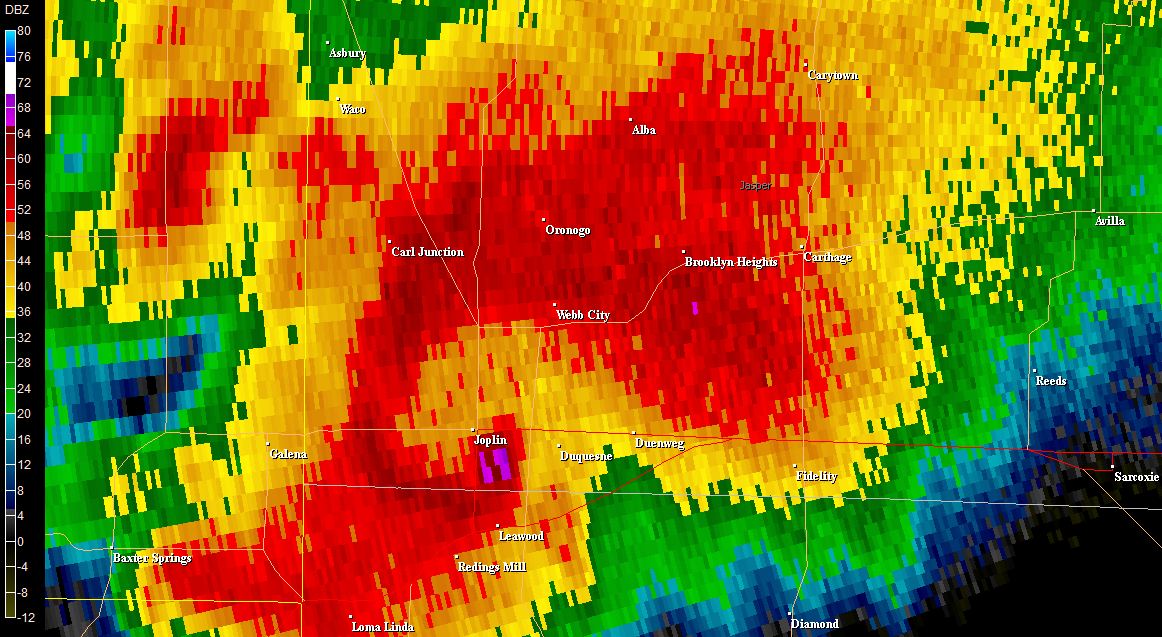
 0.5 deg base reflectivity scans at 2243Z (top) and 2248Z (bottom) show a classic hook echo along with the infamous debris ball signature.
 A cross section of the supercell reveals more about it's 2-D structure. A very strong updraft can be inferred by a weak echo region and a bounded weak echo region located between ~9,000 and ~15,000 feet above radar level.
 0.5 deg storm relative motion (using a storm motion vector of 270 deg, 24 kt) at 2243Z (top) and 2248Z (bottom) shows an intense low-level mesocyclone. The 2243Z scan had a maximum rotational gate-to-gate couplet of 188.3 kt at ~4,900 ft above radar level. The 2248Z scan had a maximum rotational gate-to-gate couplet of 185.5 kt at ~4,700 ft above radar level.
 The 2248Z volume scan shows extremely intense storm top divergence near 50,000 ft. A maximum outbound velocity of 193.8 kt and a maximum inbound velocity of 111.5 kt shows the strength of this supercell.


No comments:
Post a Comment