If applied correctly, downdraft CAPE (DCAPE) can be a useful tool to forecast potential downdraft strength. DCAPE is best utilized in weakly sheared environments where pulse and multicellular convection will dominate. To compute DCAPE, we'll first look at this qualitatively using a Skew-T (Figure 1). First, we need to find a representative mid-level wet bulb potential temperature, which will indicate where the downdraft may possibly originate. In this example, we assume the downdraft initiates around 575 hPa. However, be cognizant of the fact that most downdrafts initiate over a layer rather than a specific level. The updraft also has a wet bulb potential temperature and is found by lifting the surface parcel to its LCL. The downdraft parcel will be somewhere between the the mid-level wet bulb potential temperature and the updraft wet bulb potential temperature. Since the downdraft parcel follows a saturation adiabat, we assume the downdraft is completely saturated. The downdraft parcel is slightly warmer than the environmental temperature between 580-370 hPa. From the surface to 580 hPa, the downdraft parcel is colder than the environmental temperature, which results in a negatively buoyant layer. The level where the downdraft parcel becomes colder than the environmental temperature is called the level of free sink (LFS) and is similar to the LFC for updrafts. Therefore, DCAPE is an integration of the layer between the environmental temperature and the downdraft temperature from the surface to the LFS.
In order to determine the potential gust speed of a downdraft, we must calculate DCAPE quantitatively:
DCAPE = 1/2 * g *((Te - Tpd)/Te) * delta z
The terms of the DCAPE equation are:
g - gravity
Te - environmental surface temperature (K)
Tpd - expected downdraft surface temperature (K)
delta z - depth of negatively buoyant air (m)
For this particular case, the environmental surface temperature was 311 K, the expected downdraft surface temperature was 291 K, and the depth of the negatively buoyant air was 3,500 m.
DCAPE = 1/2 * 9.81 *((311-291)/311) * 3500 m
DCAPE = 1,104 m^2/s^2 or 1,104 J/kg
In order to calculate the maximum theoretical updraft velocity (Wmax), we use the equation Wmax =
square root (2*CAPE). We can actually substitute DCAPE for CAPE to calculate the maximum theoretical
downdraft velocity. Therefore, Wmax = square root (2*DCAPE)
Wmax = square root (2*1,104)
DCAPE = 47 m/s or 105 mph
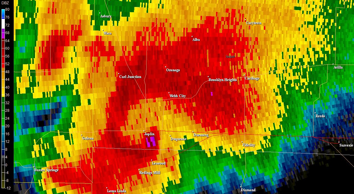
The maximum theoretical downdraft velocity can often be overestimated by almost 50%. The calculated value overestimates the potential downdraft velocity since DCAPE assumes that the downdraft is fully saturated as it descends. In actuality, the downdraft likely warms somewhere between the dry adiabatic and saturated adiabatic lapse rates since the dry subcloud air enhances evaporation, which decreases both DCAPE and the downdraft velocity. However, significant precipitation loading (> 60 dBZ reflectivity core) is not accounted for in DCAPE but can lead to stronger downdrafts than DCAPE suggests. In this particular case, the thunderstorm was too close to the radar to adequately sample whether or not precipitation loading would have contributed to the downdraft (not shown). However, judging by the sounding and the moderately unstable air mass, it's possible that precipitation loading could have played a role.
What happened on this day? A microburst produced a gust of 81 mph at Amarillo just a few hours before this sounding was released.
Friday, July 29, 2011
Sunday, July 24, 2011
July 22 Amarillo Microburst
A microburst occurred during the middle afternoon on July 22 and produced an 81 mph wind gust at Rick Husband International Airport, which tied the highest gust ever recorded at Amarillo. Instead of writing a blog post, I've decided to link to a web story our office created.
Microburst Produces 81 mph Wind Gust at Amarillo -- WFO Amarillo
Monday, July 18, 2011
Massive Heat Bubble
On the evening of July 17, an expansive 500 mb subtropical upper-level anticyclone was centered near the Kansas and Nebraska border and nearly stretched from border to border in the center part of the United States (Figure 1). The strength and placement of this feature is unusual, and in fact, standard deviations of +2.5 were common near the centroid of the anticyclone (Figure 2). When strong anticyclones like this develop, they are accompanied by unseasonably warm temperatures during the day and at night along with high moisture content. The combination of these factors creates a potentially dangerous situation because the heat can add serious stress on the human body. Accordingly, several heat-related watches, warnings, and advisories were in effect for 16 states (Figure 3) last evening. What compounds matters is that a lot of the heat is expected to be concentrated in urban areas, including Chicago, Milwaukee, and Minneapolis where many people do not have air conditioning or cannot afford to run the air conditioner.
Figure 2. 18 July 2011 00Z 500 mb height standardized anomalies.
Figure 3. Watch, warnings, and advisories for July 17.
It surprises many people to learn that heat kills more people on average that tornadoes and lightning combined. Granted, these statistics are slightly skewed by the 1995 heat wave in the Midwest that killed hundreds of people, but it proves that heat is a very underrated killer.
Kunkel, K. E., S. A. Changnon, B. C. Reinke, and R. W. Arritt, 1996: The July 1995 heat wave in the Midwest: A climatic perspective and critical weather factors. Bull. Amer. Meteor. Soc., 77, 1507–1518.


Kunkel, K. E., S. A. Changnon, B. C. Reinke, and R. W. Arritt, 1996: The July 1995 heat wave in the Midwest: A climatic perspective and critical weather factors. Bull. Amer. Meteor. Soc., 77, 1507–1518.
Wednesday, June 29, 2011
Amarillo Wake Low
An unusually strong period of damaging winds occurred during the early morning hours of June 28, 2011 across the southern Texas Panhandle. What was even more unusual was the fact that these winds occurred in the stratiform precipitation region behind a convective complex that stretched from near Pampa to southwest of Clarendon. Damaging wind gusts as high as 69 mph were measured at the Amarillo ASOS, and these strong winds even produced damage across parts of the city. Quite possibly the most remarkable stat from this event is that sustained severe wind gusts occurred continuously for almost an hour. It is believed that these damaging winds were associated with a wake low event.
Observations at 0600Z indicate a rain cooled air mass associated with convection moving across the southwestern Texas Panhandle. The temperature and dew point at Amarillo were 78 and 56, respectively along with a MSLP of 1014.7 mb. By 0700Z, strong convection was moving across Amarillo with the evaportive cooling taking place as evidence by the temperature dropping to 64 and the dew point rising to 64. It was during this time that a mesohigh had developed immediately behind the strongest convection. In fact, the MSLP had increased 4.1 mb in a hour to 1018.8 mb. By 0800Z, inexplicably, the temperature jumped to 71 and the dew point dropped to 56. At the same time, the pressure dropped a whopping 5.5 mb to 1013.3 mb and winds increased significantly in a small corridor just east of Amarillo.
The changes in temperature, pressure, and wind are best seen through these time series charts. The rapid fall drop in pressure between 0700Z and 0800Z corresponds to a sudden increase in sustained winds and gusts. The wind gust peak at 69 mph around 0753Z and again at 0841Z. At the same time, the temperature rose 7 degrees and the dew point dropped 7 degrees.
This data is consistent with other case studies (Handel and Santos, 2005) and numerical modeling of wake lows (Johnson, 2001). As described by Johnson and Hamilton (1988), wake lows form within the stratiform precipitation region behind the strongest convection. Within this area, evaporational cooling is not able to balance the adiabatic warming that occurs due to the descending rear inflow jet. This can be explained further by comparing the rainfall rate in the region of strongest convection to the stratiform region. Rainfall rates will likely be much higher in the strongest convection, thus increasing the potential for strong evaporative cooling. Meanwhile, the rainfall rate in the stratiform region is much less, which results in less potential for evaporative cooling. In addition, the ambient air within the stratiform region has usually already been evaporatively cooled to a significant degree by the preceding convection. Therefore, the effects of evaporational cooling within the stratiform region are much smaller than compared to the strongest convective region. Within the stratiform region, evaporational cooling is unable to offset the effects of adiabatic warming incurred by any descending air, which can produce locally enhanced dynamic pressure gradients, increased wind speeds, and warmer temperatures.
LAPS soundings show the lower tropospheric warming associated with the wake low between 0600Z and 0800Z. Between 0600Z and 0700Z, this warming is most pronounced between 825 mb and 720 mb with temperatures around 800 mb almost 2 degrees C warmer by 0700Z. Additional low-level warming takes place at 0800Z, and temperatures around 800 mb are almost 3.5 degrees C warmer than at 0600Z.
It is interesting to observe infrared satellite imagery where a localized area of warmer cloud tops was most pronounced from southern Randall County to western Carson County. This warm pocket also coincided with an area of higher temperatures, lower dew points, and stronger winds.
Even within the stratiform region, very little precipitation was occurring at the surface or aloft in the area of strongest winds. However, base velocities were extremely impressive, especially in the lowest 2,000 feet ARL. In the bottom image above, 60-68 kt inbound velocities were even sampled around 120 feet ARL. These base velocity winds were likely quite accurate as target motion was moving parallel to a radial.
How can wake lows be forecast? Well, it's virtually impossible to predict the formation of these phenomena in advance, but an understanding of how they form and the circumstances they form in can help forecasters to quickly recognize the potential for wake low development. Attentive monitoring of observational and radar data is the most critical element to the detection and diagnosis of wake lows.
Monday, June 13, 2011
Forecasting Severe Hail
This blog post will attempt to describe thermodynamic and dynamic characteristics I look for when forecasting severe hail. Some factors, such as storm microphysics and kinematics, are currently impossible to analyze/forecast but play an equally large role in governing the threat for severe hail.

Buoyancy: The environment was moderately unstable with a 2,435 J/kg of SBCAPE and very little SBCIN (-2 J/kg). Although the CAPE profile is fairly deep, it is rather thin. Within the hail growth zone, there appears to be about 820 J/kg of CAPE.
Deep layer shear: Despite relatively weak winds in the lowest 4 km, the degree of veering and the stronger winds near 6 km more than make up for this. 0-6 km shear of 37 kt is more than adequate. Even stronger winds are noted at 7 and 9 km.
Mid-level lapse rates: A 700-500 mb lapse rate of 6.2 C/km is respectable for a tropical environment. However, the lapse rate within the hail growth zone is closer to moist adiabatic.
Freezing level: 14,381 feet is rather high and likely allowed for more melting. The deep moist layer from the surface through ~650 mb also increased the melting potential of hail stones.
Overall threat: The threat for severe hail is pretty high based on this sounding. The buoyancy alone should allow for at least some threat for severe hail. However, the decent deep layer shear and large CAPE in the hail growth zone certainly increase the hail threat. Some negative factors for significant hail (2" or larger in diameter) are the weaker lapse rates in the hail growth zone, the high freezing level, and the moist profile from the surface to about 650 mb.
Summary: A few reports of hail up the golf ball size were reported in Broward County. This is extremely rare for the middle of June, but the thermodynamic and dynamic environment was supportive. Additionally, storm microphysics and kinematics were likely very favorable for severe hail production.
It should also be mentioned that this sounding profile was also quite favorable for wet microburst production. Indeed, several severe wind gusts were reported, including a 64 mph gust measured at Weston, FL.
Severe Thunderstorm Rocks Western Broward Metro -- WFO Miami
Saturday, May 28, 2011
May 24 Chase -- Canton Tornado
Another devastating tornado outbreak struck the southern Plains on May 24. Hardest hit was Central Oklahoma where three EF-4 tornadoes have been confirmed. By early afternoon, storms initiated rapidly along a sharpening dryline across western and Southwest Oklahoma and quickly evolved into supercells. The first supercell of the day formed near Elk City and moved toward the northeast. As the supercell passed west of Oakwood, it began to tighten up with two distinct wall clouds present for almost 10 minutes. Shortly thereafter, one dominant circulation took over, and it was obvious this storm was getting ready to produce a tornado. Indeed, a few miles west of Canton, a tornado developed, tracked northeast for nine miles, and lasted for nearly 30 minutes. Initially, the tornado was small but quickly grew to a one-half mile-wide multiple vortex stovepipe northwest of Canton. The tornado was rated an EF-3, and unfortunately, it injured two people near Canton Lake. Below are some images (courtesy of TB), video, and links documenting the storm chase. If you feel compelled to help tornado victims of this outbreak, you can donate to the American Red Cross.
A very sharp dryline across western Oklahoma served as a focusing mechanism and helped initiate supercell thunderstorm.
Classic supercell with dual wall clouds north of Thomas, OK.
Low, ragged wall cloud northwest of Oakwood, OK.
Ragged wall cloud with a well-defined beaver's tail.
Rotating wall cloud just west of Canton, OK. RFD can be seen to the left and behind the wall cloud. Rotation rapidly increased as the RFD interacted with the updraft base.
Tornado develops after RFD ingestion.
Tornado becomes larger as it moves northwest of Canton.
Large, multiple vortex tornado northwest of Canton.


VIDEOS
RELATED LINKS
Monday, May 23, 2011
Radar Images of Joplin Tornado **Updated**
Since the April 27 tornado outbreak, the weather pattern has been largely unfavorable for widespread severe weather due to a maritime tropical air mass regime remaining confined to the Gulf Coast states. However, the pattern began to change over the last several days as a western CONUS trough developed and propagated eastward. This allowed for a sustained period of moisture return across the center portion of the country. As the trough axis and embedded disturbances within the trough have ejected towards the Plains, they have encountered a much more buoyant and highly sheared environment.
The end result the last couple of days has been a return of widespread severe weather, including tornadoes, from the southern Plains to the northern Plains. The hardest hit area was Joplin, MO where an EF-5 tornado cut a damage swath up to three quarters of a mile wide across the southern part of the city yesterday evening. Most troubling is the fact that 125 deaths have been confirmed as a result of this tornado, which makes this the eighth deadliest tornado in recorded U.S. history.
My thoughts and prayers go out to all those affected by the severe weather. If you feel compelled to help victims of the tornado, you can donate to the American Red Cross. Below are some radar images of the powerful tornadic supercell as it moved across Joplin.

0.5 deg base reflectivity scans at 2243Z (top) and 2248Z (bottom) show a classic hook echo along with the infamous debris ball signature.
A cross section of the supercell reveals more about it's 2-D structure. A very strong updraft can be inferred by a weak echo region and a bounded weak echo region located between ~9,000 and ~15,000 feet above radar level.

0.5 deg storm relative motion (using a storm motion vector of 270 deg, 24 kt) at 2243Z (top) and 2248Z (bottom) shows an intense low-level mesocyclone. The 2243Z scan had a maximum rotational gate-to-gate couplet of 188.3 kt at ~4,900 ft above radar level. The 2248Z scan had a maximum rotational gate-to-gate couplet of 185.5 kt at ~4,700 ft above radar level.
The end result the last couple of days has been a return of widespread severe weather, including tornadoes, from the southern Plains to the northern Plains. The hardest hit area was Joplin, MO where an EF-5 tornado cut a damage swath up to three quarters of a mile wide across the southern part of the city yesterday evening. Most troubling is the fact that 125 deaths have been confirmed as a result of this tornado, which makes this the eighth deadliest tornado in recorded U.S. history.
My thoughts and prayers go out to all those affected by the severe weather. If you feel compelled to help victims of the tornado, you can donate to the American Red Cross. Below are some radar images of the powerful tornadic supercell as it moved across Joplin.


Subscribe to:
Posts (Atom)